Paddleboarding the Esk in North Yorkshire
It's early afternoon on an unusually hot and sunny Yorkshire day. I'm standing on my paddleboard on the tidal section of the River Esk, near Whitby's New Bridge, as cars stream across. The 28-mile-long Esk is special, as it is the only major river in Yorkshire that flows directly into the North Sea.
Ahead of me is a bustling marina, the famous abbey and the West and East piers. The town is full to the brim with visitors in search of the best fish and chips, amusement arcades and tales of Dracula and Captain Cook. Later, in the autumn, goths in their finery will parade the cobbled streets.
Here on the river, however, it is tranquil. A salmon leaps from the water to my right, bubbles rise from the seaweed beneath my board, and to my left, the riverbank absorbs abandoned boats into its grassy knolls. On an evening paddle, you might spot the crews from one of the town's three main rowing clubs (Whitby Coastal, Friendship or Fisherlads).
You can launch from the slipway at the far end of the marina back car park near Coates Marine. Arriving by train or bus, it's a few minutes' walk from the station. Launch about one and a half hours before high tide and head right towards the New Bridge and Ruswarp. Be mindful, this section of the river is tidal and water levels do drop.
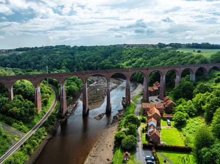
After taking in the magnificent view, I turn and paddle towards Ruswarp, a couple of miles inland, passing under the Larpool Viaduct, which carries the 22-mile Cinder Track. Branches of willow trees droop elegantly into the water offering welcome shade. Swans glide past and Highland cattle graze nonchalantly in the fields. A couple hike the path that runs alongside the river.
I first paddled on the Esk with my young sons in 2006. Twenty years later, it still remains a peaceful, hidden gem. We hired kayaks from Ruswarp Pleasure Boats (established 1874) just above the weir, which also rents rowing boats and now paddleboards. For a £5 fee, it offers a private jetty to launch your own craft, which is ideal as access to the river is very limited along this stretch. There is free parking on the roadside here, and with the number 95 bus stop (Arriva) nearby, public transport is an option. Paddle up to Perry's Plants garden centre at Briggswath just before Sleights and then turn back.
You'll pass the Waterside restaurant and Whitby Wellbeing's wild sauna along the way, so family and friends can eat, sweat or dip while you float along, letting the river carry your worries away. Afterwards, nip to Botham's in Sleights for some Resolution tea and lovely iced lemon buns. I promise, it'll be a grand paddleboarding day out in Yorkshire.
Jo Moseley is the author of Stand-Up Paddleboarding in Great Britain
Wild camping on the Dart in Devon
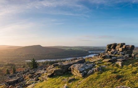
On the uplands of Dartmoor, two tributaries – the East Dart and West Dart – join beneath ancient woodland at the well-named hamlet of Dartmeet. They entwine as the River Dart, which flows for 47 miles from open moor into steep wooded valleys and passes peat bogs and tors, oak forest, market towns and rolling pasture before it runs into the sheltered waters of the south Devon coast.
Its upper reaches retain a pristine wildness that feels increasingly rare in southern England. The Dartmoor national park is criss-crossed by some of the cleanest bodies of water in the country, home to salmon, sea trout and otters, while the wooded valleys below are rich remnants of ancient temperate rainforest.
The Dart's name is thought to derive from an old Celtic word meaning "river where oak trees grow", and the lower banks are indeed lined with native oak trees, thick with mosses and ferns. It may be one of Britain's smaller protected landscapes, but Dartmoor feels remarkably untamed. You can cross it on foot in a few days, yet it's surprisingly easy to lose yourself in the rolling mists, twisting woodlands and miles of open moorland of this ethereal landscape.
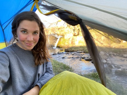
It's that sense of freedom that keeps drawing me back. I love nothing more than stuffing a tent into my rucksack and heading out on foot for a riverside camp, following the Dart and its web of streams and creeks until I find a quiet bend or grassy bank for the night. I fall asleep to the steady rush and rumble of the water and wake up early for a swim in one of its deep, crystal-clear pools before packing up and walking on.
I can roam about like this because Dartmoor is the only place in England where wild camping is legally permitted. In the national park, "backpack", or wild camping, is allowed for one or two nights in some areas, provided you stay away from roads and settlements and leave no trace of your visit.
Sometimes, I have company on the riverbanks. I've huddled in bivouac bags with friends and woken totally covered in sparkling droplets of dew. I've camped on the water's edge and woken in the middle of the night to what sounded like an invading army around my tent. It turned out to be a troop of scouts, arriving spectacularly late at their campsite and gamely pitching flimsy-looking tents by the light of their headlamps. And once, at dusk, I think I glimpsed the sleek head of an otter slipping into the current. But more often than not, once evening falls and I sit by the door of my tent watching the water darken, I have the Dart all to myself.
Fishing on the Dove in the Peak District
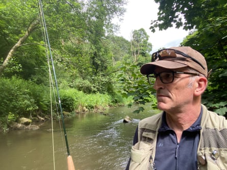
There's a trout rising upstream from where I am standing on the bank of the River Dove in Beresford Dale, on the border of Staffordshire and Derbyshire. I mark the spot – just beyond that overhanging tree branch – and rue the fact that it will make casting a fly without getting snagged tricky. I need to get into the river and wade over to the other bank for a clear shot. But it's a steep drop to the water and the pools look deep in this stretch; deep enough to go over my chest waders. I walk back downstream to a spot where I can safely enter the fast-flowing river, but realise it's going to be a long wade upstream. Too long and splashy, which will disturb any fish and scatter them. So, I get out again and walk back to where I first spotted the feeding trout. I am caught in indecision, and repeat this pattern several times before giving up on this particular quarry.
The meander at this section of the river has formed a little peninsula, and standing in the middle of it is a fishing hut, where I go to drink a coffee and consider my tactics. This isn't any old fishing hut, however. This one is a substantial structure, built from stone, with pillars framing the door and with an inscription in Latin, "Piscatoribus Sacrum" (Sacred to all Fishermen).
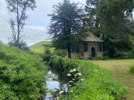
In the lintel stone is a cypher of intertwined letters: CC and IW, for Charles Cotton, the poet who built this "little fishing house" on his estate in 1674, and Izaak Walton, who wrote The Compleat Angler in 1653. Cotton added "Instructions how to angle for a trout or grayling in a clear stream" to accompany the fifth edition of Walton's book, considered to be the first technical manual of fly-fishing and one of the most reprinted books in the English language.
The River Dove is the spiritual home of fly-fishing because of Walton and Cotton, and it still holds a mythical place in fishers' minds. As someone who grew up on the Staffordshire-Derbyshire border, and fished the Dove where it joins the River Trent at Newton Solney in my youth, I was well aware of the river's special status. But, at that age, I wasn't about to give myself the extra homework of reading a 17th-century treatise on fishing and nature. Instead, an English teacher who fished furnished me with the only line I needed to know: "you will find it one of the purest crystalline streams you have seen."
The stretch of the Dove I'm fishing – called the Temple beat after Cotton's fishing house – races and tumbles through a narrow tree-lined dale hemmed in by limestone crags. Near the bridge above a section known as the Pike Pool, a family is splashing and paddling in the early summer sunshine. There's a popular 4-mile loop that starts at Hartington village, and the path is too busy with walkers to fish, so I enter the river at the bridge and wade and fish "the vale it winds through like a snake" until I spot the rising trout and stop for my coffee break.
Later that day, I lose all sense of time in the hypnotic flow of catching and releasing a series of small wild brown trout. Just beyond the fishing house, someone has carved a large hole into the base of a dead oak tree, the perfect place to sit and watch dippers skit along the banks and damselflies dance upon the surface. A little further on, a large Hereford cow is drinking from the river, framed by overhanging trees and with a verdant conical hill in the background. The scene strikes me as being a pastoral masterpiece, much like The Compleat Angler.
A day ticket on the Temple beat can be booked through
the Severn and Wye in mid-Wales
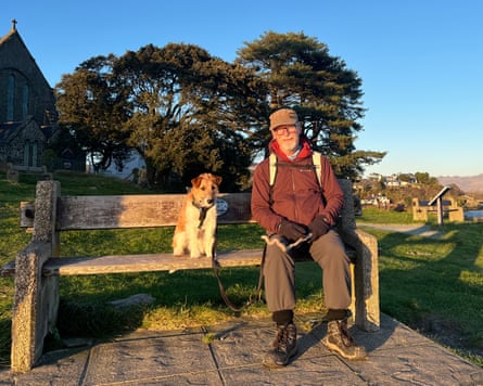
It will prove to be the best of hikes, and in some ways the worst. I start out early from Eisteddfa Gurig on the A44, hoping to get going while the day is cool. My plan is to visit the sources of two of Britain's greatest rivers – the Severn and the Wye which, by a fluke of geography, lie a couple of miles apart on a mountain ridge in mid-Wales.
The path leads me up Pumlumon Fawr, a 752-metre (2,467ft) massif with magnificent views to the Irish Sea. The day is scorching hot and the bald sheep-nipped hills look only an inch of topsoil away from becoming a desert. Of the two rivers, the Severn gets the finer start in life. There is a marker post next to a deep, dark pool of water that is being squeezed from the bog. In ancient times, humans worshipped springs, but there are no garlands here, only a few sea shells carried upstream by hikers from the Bristol Channel on the 224-mile (360km) Severn Way.
A short walk downstream brings me into a deep valley where the Severn, already gathering force, bounces through ferny glades. It feels as if someone is caring for this river, determined to give it a good start in life. There is a useful car park further down the valley, but I cut away through the forest to find the origin of its twin, the Wye.
I have hopes of a dip in a mountain pool, but there are misgivings. Arguably the loveliest river in Britain, the Wye has been hitting headlines for a severe decline in water quality. Dead salmon have been found, algal blooms reported. Campaigners, however, have scored a major victory in creating a charter of rights, including the right to flow and be free of pollution. Significant authorities, including Powys and Herefordshire, have adopted it. There is hope.
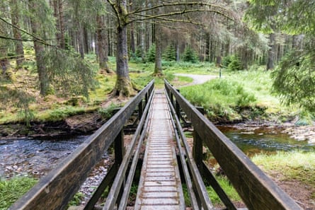
The first omen is the defunct Nant Iago lead mine, a reminder that human impact on the environment is nothing new. Government statistics show that about 900 miles (1,500km) of our rivers and estuaries are still contaminated by 19th-century mines. I skirt around the old workings and walk up the valley. In the wrinkles of this hillside, the Wye has a moorland birth, a harsh ordeal. No sooner has the clean, bright water started out than it's being crapped in by sheep and messed about by humans. Any thought of a dip in a pool, or even a sip from the source, is brutally quashed.
The moorland/forested contrast with the Severn is not unplanned: scientists have been controlling and assessing these non-identical twins since a time when flood risks and algal blooms were not issues. Whatever their conclusions, however, our expectations of rivers remain pitifully low. In 17th-century Britain, by contrast, salmon were so plentifully available for people to fish for themselves that there was little market for them.
I carry on down the Wye Valley Walk, a 136-mile route whose leaping salmon logo is looking sadly inappropriate. After a few miles, I turn west up a side stream that has a toxic reddish tint. Only a Martian would take a dip. This has become a grim trudge, but finally, up a side valley, I stumble on deep pools alive with tiny frogs. Spruce and pine have been planted. There are orchids and bog asphodels. Then, a magnificent golden-ringed dragonfly settles next to me. My spirits are restored. Maybe the Wye can bounce back. I set off for nearby Llangurig where there's a pub, the Bluebell Inn, and a tearoom.
the Tay in Perthshire
The Tay is Scotland's longest river (117 miles) and Britain's mightiest, discharging more water than the longer Thames and Severn combined. Rising on the slopes of Ben Lui in Argyll, gathering strength from Highland burns before widening through Perthshire and eventually reaching the North Sea at Dundee.
It's the middle stretch, from Killin to Dunkeld through Highland Perthshire, that I love best. At Killin, we've happily lost whole afternoons to picking wild raspberries, skimming stones and climbing trees. My boys climbed their first Munro here, Ben Lawers, when their legs were much shorter. We should have had beautiful loch views from the top, but reached the summit in cloud instead. They loved it.
Further along the banks at Lawers and Kenmore is where my sisters and I head for restorative escapes: alternating freezing loch swims with a hot tub has become our preferred form of therapy.
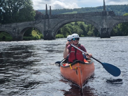
I've often walked by the river, but was curious to see it from a different angle: by canoe. Aberfeldy is a two-hour drive north from Edinburgh, so it's an early start for me and my son Louis, 15. We're welcomed at Beyond Adventure with coffee and a briefing, then transferred upriver with two long orange canoes and our instructor, Kevin Meldrum.
Our route begins on the River Lyon just before its confluence with the Tay. In this calm eddy, we get a quick lesson in paddling and turning the boat. Louis is 6ft-plus and I am not, which seemed a recipe for paddling in circles. Kevin keeps us right, and Louis soon learns to calmly counteract any erratic paddling on my side. We meet the Tay over a gentle rapid and begin paddling downstream. We settle into the river's rhythm, learning to read the current and steer around camouflaged anglers patiently waiting for salmon, and spotting herons standing guard in the shadows.
The banks of the Tay are changing, thanks to the returning beaver population. We don't spot any (they emerge at dusk), but we do see evidence of stripped bark and felled trees by the river. Paddling into a tree-lined eddy, we admire a carefully constructed beaver lodge.
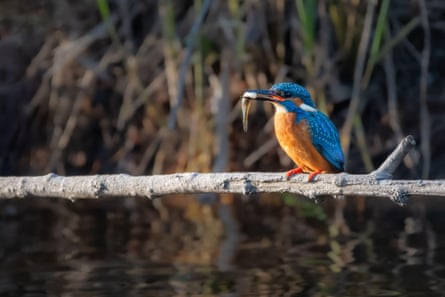
We pull the canoes ashore on a little island for a picnic lunch, and as we eat our sandwiches, there's a flash of iridescent turquoise. My first ever sighting of a kingfisher.
It's great to be on the water with a guide who knows the river so well. At each stretch of rapids, we're set a route, and navigate each one facing downstream, still smiling. As we return to Aberfeldy, we paddle under General Wade's Bridge, unchanged since it was built in 1733. We've been on the water for three hours, but it feels all too soon when we approach the Beyond Adventure base. Reluctant to leave, we find a deep, peaty pool for a swim.
Heading home, we stop for a pizza (a teenage second lunch) and cold drinks at The Taybank in Dunkeld. Watching the Tay flow past the beer garden, I realise the river looks different to me now. Once you've travelled with it, it's hard not to wonder what's waiting around the next bend.
Beyond Adventure offers half-day discovery canoeing tours from £63 adults, £47.25 children, £199.50 for a family (two adults, two children)