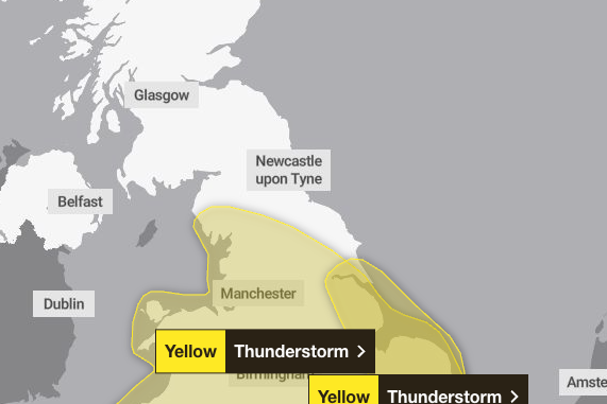
People across the UK have been urged to prepare an “emergency kit” as flooding and thunderstorms are expected to hit large areas of the country.
A yellow weather warning for thunderstorms is in force across huge swathes of England and Wales on Thursday as heavy rain batters the UK.
The Met Office has issued an urgent warning encouraging people to consider whether their homes are at risk of flooding, and if so, to prepare a flood plan and emergency supplies ahead of potential disruption.
It advises those in at-risk areas to prepare a bag including insurance documents and a list of contact numbers, a torch and spare batteries, a first aid kit and any prescription medicines, warm waterproof clothes and blankets, bottled water and snacks, a battery-powered or wind-up radio, and supplies for looking after a baby or pet if needed.
A band of thunderstorms and heavy rain is expected to move north across England and Wales throughout the day, dropping up to 50mm of rain across a 12-hour period in some places.
Parts of the West Midlands have already been hit by flooding following a warning for the Perry Barr district on Wednesday night, brought on by swelling river levels.
Forecasters have issued a yellow warning covering the East of England, East Midlands, West Midlands, London and south-east England, north-west England, south-west England, Yorkshire and the Humber, and Wales from 5am until 10pm on Thursday.
A total of 81 areas are covered by the warning.
A second warning covering parts of the East Midlands, east of England, London and south-east England, and Yorkshire and the Humber, is also in place from 5pm on Thursday to 7am on Friday.
The Environment Agency has issued one flood warning, meaning flooding is expected, and 39 flood alerts, meaning flooding is possible, across England.
Forecasters have warned of potential disruption and said there is a “small chance” of flooding impacting homes and businesses and posing a risk to life. Public transport and infrastructure could be affected by the conditions, with drivers urged to watch out for spray and sudden flooding on the roads.
The South East warning area could see 30 to 40mm of rainfall and “fairly large hail between 1 to 2cm”, while the bigger warning area could have more than 75mm of rain through 12 hours in parts, Met Office forecaster Craig Snell said.
Temperatures will drop closer to average for the time of the year over the weekend, with highs of 24 or 25C on Friday, then 22 or 23C until Monday.
Mr Snell added: “We’re watching the risk of some heavy rain and thunderstorms moving up from the south.
“On Thursday as we wake up there will be a band of potentially heavy rain and thundery rain stretching across parts of the UK.
“For parts of the Midlands and Wales it’s going to be quite a wet day really. We could see some further thunderstorms move into the south east around Thursday evening.”
Mr Snell said: “To sum up the bank holiday weekend, it’s going to be pretty unsettled; there will be some sunny moments in between if you can dodge the downpours.
“It’s not going to be a complete washout. If you’ve got outdoor plans over the weekend, keep a close eye as there will be rain moving in across most parts.”
Full list of areas covered by Thursday’s yellow weather warning
East of England
London & South East England
- Windsor and Maidenhead
- Isle of Anglesey
- Vale of Glamorgan
- Kingston upon Hull