The record for the number of days reaching 30C in any year has been broken, according to the Met Office.
After several locations exceeded 30C on Sunday, it has now confirmed that there have been a total of 35 days where the maximum daily temperature has exceeded this threshold - beating the 34 days set in 1995.
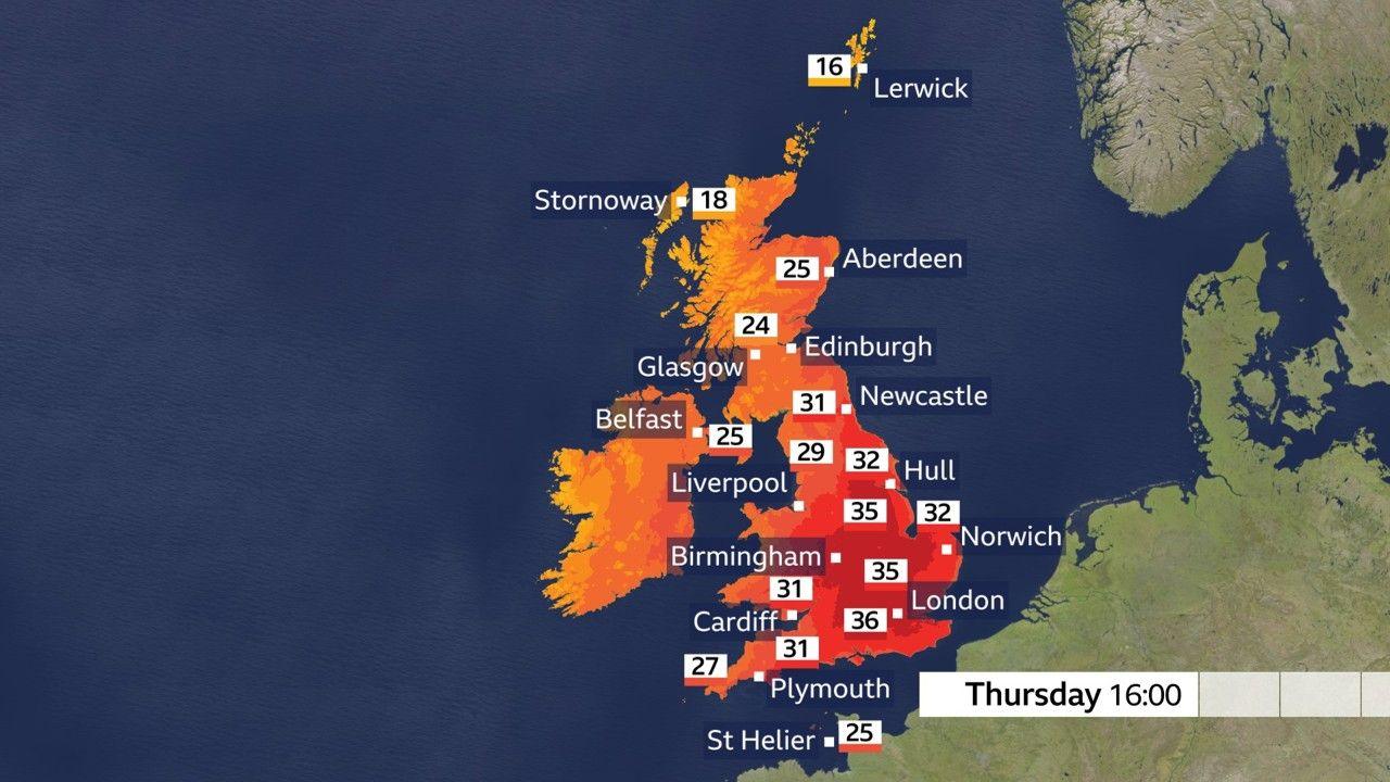
This tally is widely expected to be topped again on Wednesday and Thursday with temperatures peaking in the mid-to-high 30s across the Midlands and south-east of England.
A rare amber extreme heat warning has been issued by the Met Office for Thursday.
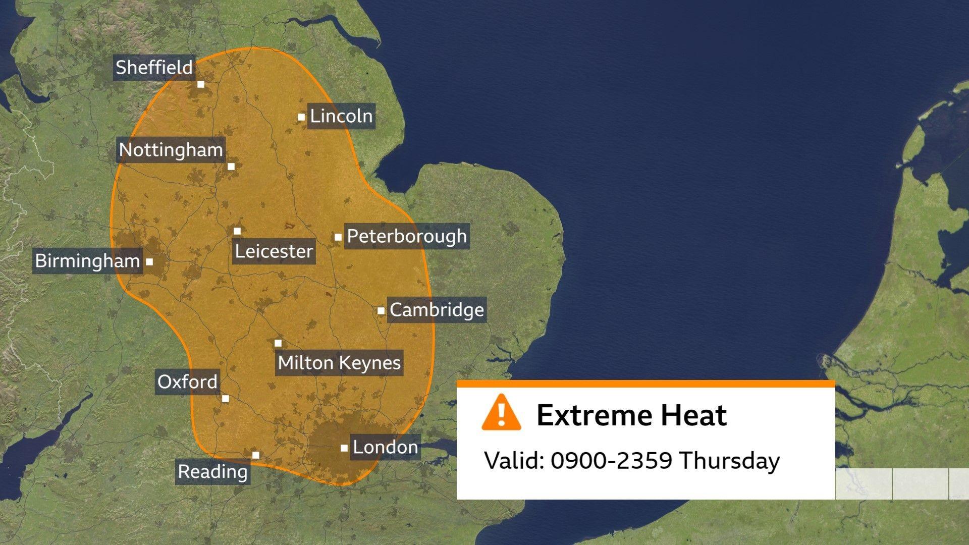
The hottest weather this week is expected on Thursday across the Midlands, Eastern England, London and south-east England, Yorkshire and Humber.
Temperatures could potentially reach 38C which would equal the highest temperature of the summer so far recorded at Lingwood in Norfolk on 26 June.
This would be the hottest August day since 2003, when 38.5C was recorded.
It is also likely to be the fourth calendar month this year to record 35C or more, which is unprecedented.
Amber heat health alerts also in force
The UK's Health Security Agency has also issued amber heat health alerts, which cover the whole of England.
Heat health alerts warn the public and medical professionals when periods of hot or cold weather pose a threat to health.
The alerts are in place until Friday evening.
When will the heatwave end?
This heatwave should be shorter lived than others so far this summer with temperatures starting to feel noticeably cooler over the weekend.
Scotland and Northern Ireland will not experience the same extreme heat as southern England, although eastern parts of Northern Ireland, southern and eastern Scotland will still see temperatures well above the heatwave threshold.
They will be notably above average for mid-August and the humidity is likely to intensify on Wednesday night into Thursday.
Some places could reach the mid to high 20s Celsius on Wednesday - when a typical August daytime temperature would generally be in the high teens to low 20s.
Western Scotland and western parts of Northern Ireland are likely to remain somewhat cooler due to cloud and occasional rain moving in from the Atlantic.
While confidence in the details remains low, this could open the door for showers and perhaps some prolonged spells of rain.
To alleviate drought though, months of above-average rainfall is needed.